


Introduction
The demand for highly accurate and detailed spatial data is rapidly increasing across industries such as infrastructure, transportation, construction, and urban planning. Traditional surveying methods, while reliable, often require significant time and labor. Today, 3d mobile mapping Technologies Driving the Next Generation of Spatial Data are transforming how geospatial information is captured and analyzed. By combining advanced sensors, GNSS systems, LiDAR, and imaging technologies, mobile mapping solutions are enabling faster, safer, and more precise data collection.
Understanding 3D Mobile Mapping Technology
3D mobile mapping refers to the process of collecting geospatial data using sensor-equipped vehicles or portable platforms that move through an environment while capturing information. These systems typically integrate LiDAR scanners, cameras, inertial measurement units (IMUs), and GNSS receivers to generate accurate three-dimensional representations of the physical world.
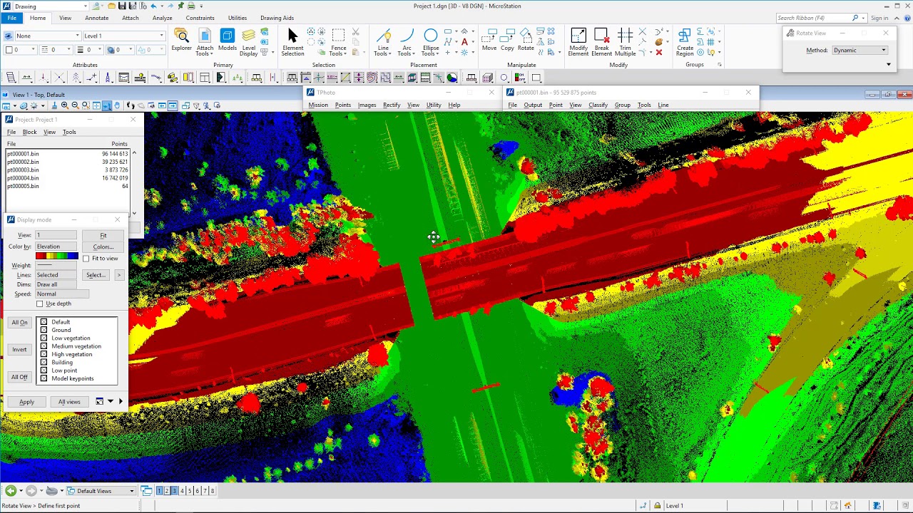
With 3D Mobile Mapping Technologies Driving the Next Generation of Spatial Data, surveyors can capture millions of data points in a single pass, creating dense point clouds and high-resolution imagery. This level of detail helps professionals visualize environments more effectively and make informed decisions.
Key Components of Modern Mobile Mapping Systems
Modern mobile mapping systems rely on a combination of advanced technologies to ensure accuracy and efficiency.
LiDAR Sensors
LiDAR technology emits laser pulses to measure distances between the sensor and surrounding objects. These measurements create detailed 3D point clouds that represent terrain, infrastructure, and environmental features.
GNSS and Positioning Systems
Global Navigation Satellite Systems provide precise positioning data, ensuring that captured spatial information is accurately georeferenced.
High-Resolution Imaging
Cameras capture panoramic and high-definition images that complement LiDAR data, providing visual context for mapping and analysis.
Together, these technologies illustrate how 3D Mobile Mapping Technologies Driving the Next Generation of Spatial Data are delivering richer datasets than ever before.
Applications Across Multiple Industries
3D mobile mapping is revolutionizing many sectors that rely on spatial information.
Urban Planning and Smart Cities
City planners use mobile mapping data to analyze infrastructure, monitor urban growth, and design smarter transportation systems.
Transportation and Highway Projects
Mobile mapping systems help engineers evaluate road conditions, map assets, and plan maintenance work with minimal disruption to traffic.
Utility and Infrastructure Management
Utility companies use mobile mapping to inspect power lines, pipelines, and other assets, improving maintenance planning and operational efficiency.
These real-world applications demonstrate why 3D Mobile Mapping Technologies Driving the Next Generation of Spatial Data are becoming essential for modern geospatial workflows.
Advantages of 3D Mobile Mapping
Organizations adopting mobile mapping technologies benefit from several key advantages:
- Speed: Large areas can be surveyed quickly without stopping traffic or disrupting operations.
- Accuracy: High-density point clouds provide detailed and reliable spatial data.
- Safety: Data collection can be performed from moving vehicles, reducing field risks.
- Cost Efficiency: Faster data capture reduces labor and operational costs.
These advantages allow professionals to collect more data in less time while maintaining high levels of precision.
The Future of Spatial Data Collection
As technology continues to evolve, mobile mapping systems will become even more powerful. Advances in artificial intelligence, real-time processing, and cloud-based data management will further enhance the value of geospatial data. Integration with digital twins and smart infrastructure platforms will enable organizations to monitor and manage environments in real time.
With continuous innovation, 3D Mobile Mapping Technologies Driving the Next Generation of Spatial Data will play a crucial role in shaping how industries capture, analyze, and use spatial information.
Conclusion
3D mobile mapping has emerged as a transformative tool in the geospatial industry. By combining advanced sensors, positioning technologies, and powerful data processing capabilities, these systems provide an efficient way to capture highly detailed spatial information. As industries increasingly rely on accurate geospatial insights, 3D Mobile Mapping Technologies Driving the Next Generation of Spatial Data will continue to redefine how we understand and manage the physical world.
